 Catalogue GéoSAS
asNeeded
Type of resources
Available actions
Topics
Keywords
Contact for the resource
Provided by
Years
Formats
Representation types
Update frequencies
status
Scale
Resolution
-

Les barrages sont à l’origine de modifications significatives du régime hydrologique, de la température de l’eau et des flux biologiques et biogéochimiques. C’est le cas des barrages de Vezins et de la Roche qui Boit, présents sur le cours principal de la Sélune, et d’autres plus petits obstacles qui fragmentent le bassin versant de la Sélune. Cette couche représente les barrages hydroélectriques de la Sélune, avec les batiments associés, en lien avec la production électrique. La géométrie de ces polygones est issue de plusieurs sources : BD Topo, OpenStreetMap (de 2019), complétée par photointerprétation. Des informations extraites du livre « Quand les rivières reprennent leur cours – Notes sur l’effacement de barrages et de seuils, sur la Sélune et ailleurs » ont été ajoutées pour décrire l'état (en service ou arasé), la nature et les caractérisques physiques de ces barrages.
-
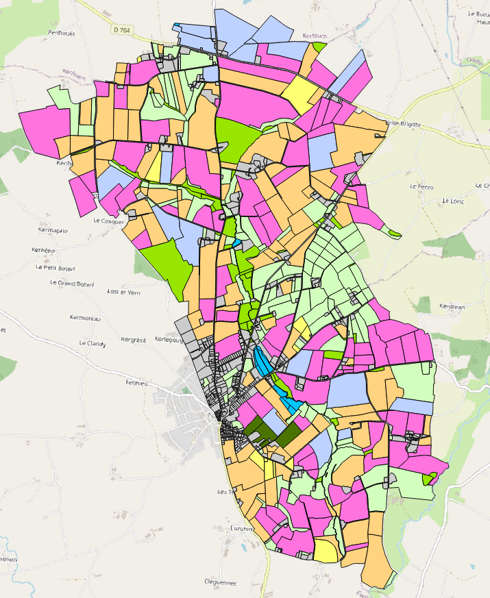
Occupation des sols 2006 du bassin versant du site de Naizin dans le Morbihan dans le cadre de l'Observatoire de Recherche en Environnement (ORE) AgrHyS d'INRAE. Le parcellaire est issu du cadastre de 2013. Les dessertes ont été redessinées à partir des orthophotos IGN de 2013 et le parcellaire a été découpé en fonction d’une zone tampon autour de ces dessertes. Les parcelles 2013 peuvent être découpées mais jamais regroupées. Toutes les entités géographiques élémentaires ont un identifiant unique sur l’ensemble des années. Champs de la table d’attribut : • ID_2006 : identifiant de la parcelle pour l’année 2006 • TYPE_06 : code principal de l’occupation des sols • S_TYPE_06 : code secondaire de l’occupation des sols • ID_ILOT : Identifiant numérique et non significatif par îlot du RPG 2006 • CODE_GROUP : code du groupe de cultures du RPG 2006 La nomenclature de ces codes des types et sous-types a été définie dans le programme ANR-12-AGRO-0005 MOSAIC : https://anr.fr/Projet-ANR-12-AGRO-0005. Leurs descriptions peuvent être télécharger ici : https://geosas.fr/metadata/ore/xls/legendes_osol_naizin.xlsx. Les occupations des sols sont issues des données par ilot du Registre Parcellaire Graphique (RPG) de l’année 2006. Les limites des parcelles ont été mises en concordance avec le parcellaire de 2013.
-
Occupation des sols 2022 du bassin versant du site de Naizin dans le Morbihan dans le cadre de l'Observatoire de Recherche en Environnement (ORE) AgrHyS d'INRAE. Le parcellaire est issu du cadastre de 2013. Les dessertes ont été redessinées à partir des orthophotos IGN de 2013 et le parcellaire a été découpé en fonction d’une zone tampon autour de ces dessertes. Les parcelles 2013 peuvent être découpées mais jamais regroupées. Toutes les entités géographiques élémentaires ont un identifiant unique sur l’ensemble des années. Champs de la table d’attribut : • ID_2022 : identifiant de la parcelle pour l’année 2022 • ID2_2022 : identifiant "bis" (lors de subdivision culturale) de la parcelle pour l'année 2022 • TYPE_22 : code principal de l’occupation des sols • S_TYPE_22 : code secondaire de l’occupation des sols • ID_PARCEL : identifiant numérique et non significatif par parcelle du RPG 2022 • CODE_GROUP : code du groupe de cultures du RPG 2022 • CODE_CULTU : code du groupe de cultures majoritaire du RPG 2022 • CULTURE_D1 : code de la culture dérobée (culture intercalée entre 2 moissons de culture principale) sur la parcelle. • CULTURE_D2 : code de la seconde culture dérobée (culture intercalée entre 2 moissons de culture principale). • SURF_PARCEL : surface en hectares de la parcelle La nomenclature de ces codes des types et sous-types a été définie dans le programme ANR-12-AGRO-0005 MOSAIC : https://anr.fr/Projet-ANR-12-AGRO-0005. Leurs descriptions peuvent être télécharger ici : https://geosas.fr/metadata/ore/xls/legendes_osol_naizin.xlsx. Les occupations des sols sont issues des données par parcelles du Registre Parcellaire Graphique (RPG) de l’année 2022. Les limites des parcelles ont été mises en concordance avec le parcellaire de 2013.
-
Registre Parcellaire Graphique anonymisé des Côtes d'Armor et rotations culturales de 2006 à 2014. La rotation culturale indiquée correspond à celle de la parcelle principale de chaque ilot déclaré à la PAC en 2014. Travail réalisé par l'UMR AGIR INRA et l'ODR INRA. Un identifiant non signifiant permet de retrouver les ilots d'une même exploitation.
-
Cette couche représente l'emprise des cartes pédologiques existantes en Bretagne, aux échelles plus fines que le 1/250 000. Ces cartes couvrent environ 45% environ du territoire breton à des échelles allant du 1/100 000 au 1/5 000. Ces cartes ont été réalisées entre 1970 et 1990 pour la plupart, afin de répondre à des thématiques diverses (valeurs es terres agricoles, secteur de référence drainage, connaissance des sols, plans d’épandage…). Ces cartes sont disponibles sous plusieurs formats : image ou vectoriel, avec le cas échéant une table attributaire plus ou moins complète. La légende distingue d'une part le format (nature du trait de contour de la carte pédologique) et d'autre part l'échelle (couleur du trait de contour de la carte pédologique). La table attributaire se compose des champs suivants : - NOM : Nom de la carte composé de sa localisation et de l'échelle correspondante - FORMAT : Format de la carte : scan ou vecteur - ECHELLE : Échelle de la carte - DEPART. : Département(s) dans le(s)quel(s) la carte se situe - DATE : Année de publication de la carte - AUTEUR : Auteur de la carte
-
Occupation des sols 2020 du bassin versant du site de Naizin dans le Morbihan dans le cadre de l'Observatoire de Recherche en Environnement (ORE) AgrHyS d'INRAE. Le parcellaire est issu du cadastre de 2013. Les dessertes ont été redessinées à partir des orthophotos IGN de 2013 et le parcellaire a été découpé en fonction d’une zone tampon autour de ces dessertes. Les parcelles 2013 peuvent être découpées mais jamais regroupées. Toutes les entités géographiques élémentaires ont un identifiant unique sur l’ensemble des années. Champs de la table d’attribut : • ID_2020 : identifiant de la parcelle pour l’année 2020 • TYPE_20 : code principal de l’occupation des sols • S_TYPE_20 : code secondaire de l’occupation des sols • ID_PARCEL : Identifiant numérique et non significatif par parcelle du RPG 2020 • CODE_GROUP : code du groupe de cultures du RPG 2020 • CODE_CULTU : code du groupe de cultures majoritaire du RPG 2020 • CULTURE_D1 : code de la culture dérobée (culture intercalée entre 2 moissons de culture principale) sur la parcelle. • CULTURE_D2 : code de la seconde culture dérobée (culture intercalée entre 2 moissons de culture principale). La nomenclature de ces codes des types et sous-types a été définie dans le programme ANR-12-AGRO-0005 MOSAIC : https://anr.fr/Projet-ANR-12-AGRO-0005. Leurs descriptions peuvent être télécharger ici : https://geosas.fr/metadata/ore/xls/legendes_osol_naizin.xlsx. Les occupations des sols sont issues des données par parcelles du Registre Parcellaire Graphique (RPG) de l’année 2020. Les limites des parcelles ont été mises en concordance avec le parcellaire de 2013.
-
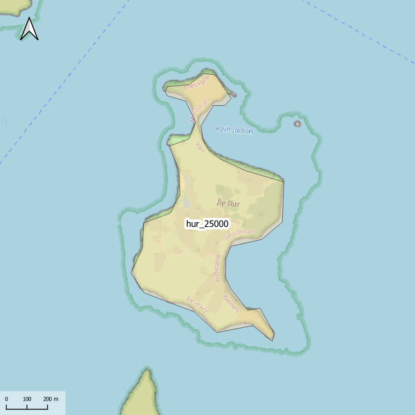
Emprise de la carte pédologique de l'île Ilur au 1/25000. La donnée de base, au format image scannée, n'est pas publiée.
-
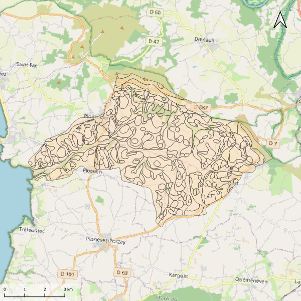
Carte pédologique de Kervijen au 1/25000. La codification correspond au code 4 critères des sols du Massif armoricain (voir ressources en ligne). Les champs de la table attributaire sont : - SUB : Matériau(x) parental(aux) à partir du(des)quel(s) se développe(nt) le sol - HYD : Classe d'hydromorphie, de 0 (sol bien drainé) à 9 (sol extrêmement hydromorphie) - TYPE : Développement de profil défini à partir de la succession des horizons - PROF : Profondeur du sol, classée de 1 (sols très épais) à 6 (sols superficiels) - CODE4C : code 4 critères issu de la concaténation des champs précédents. Les valeurs prises par les différents champs pour chaque entité sont détaillées dans la méthode 4 critères (voir ressources en ligne). - UTS : Numéro d'Unité Typologique de Sol issue du Référentiel Régional Pédologique de Bretagne.
-
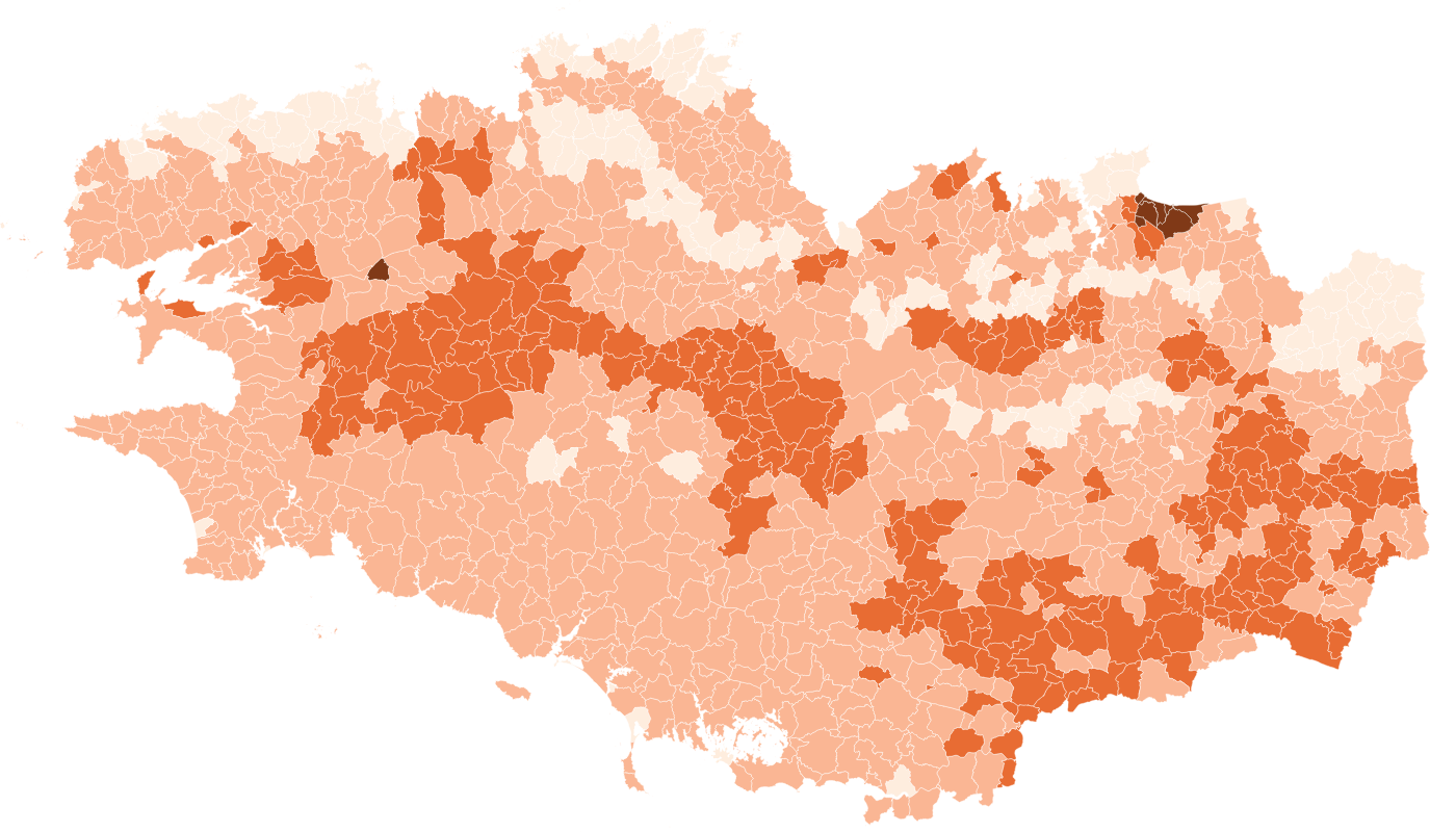
La proportion médiane d'argile par commune des sols Bretagne a été estimée pour la région Bretagne à partir du Référentiel Régional Pédologique de Bretagne. Le vecteur est composé de six bandes, correspondant aux valeurs médiane d'argile à six profondeurs standards : 0-15 cm, 5-15 cm, 15-30 cm, 30-60 cm, 60-100 cm et 100-200 cm. Les valeurs sont exprimées en pourcentage.
-

La vallée de la Sélune subit actuellement d’importants changements dans la morphologie de ses berges et de son cours d’eau. Ainsi, l’analyse des interactions entre zone aquatique et zone riveraine dans ce contexte de restauration représente une opportunité scientifique unique de compréhension des mécanismes écologiques qui sous-tendent non seulement la résilience, mais aussi le fonctionnement global des écosystèmes. Le projet « interaction entre zones aquatiques et riveraines » (RestaurE) étudie le rétablissement du fonctionnement des écosystèmes de la Sélune (résilience). Il considère les interactions entre la morphologie du fleuve, la recolonisation de l’eau et des berges par la végétation et par les espèces d’invertébrés aquatiques et terrestres. Ce projet de recherche a pour objectif d’amorcer l’analyse des néo-habitats issus de la restauration de la Sélune en se concentrant sur les interactions terrestres/aquatiques au niveau des interfaces riveraines. Il permettra ainsi de comprendre le rôle spécifique de ces interactions dans le processus de résilience des écosystèmes en restauration. L’étude des interactions entre zones aquatiques et riveraines sur la Sélune est réalisée sous deux angles : (1) Caractériser le fonctionnement bio-géo-morphologique du cours d’eau et de ses berges ; (2) Étudier le fonctionnement des réseaux trophiques (aquatiques et terrestres). Cette couche donne la localisation des secteurs d'étude utilisés dans le cadre du projet "RestaurE".