 Catalogue GéoSAS
biota
Type of resources
Available actions
Topics
Keywords
Contact for the resource
Provided by
Years
Formats
Representation types
Update frequencies
status
Scale
Resolution
-
Un barrage bloque le passage de nombreuses espèces de poissons migrateurs, mais certaines pas totalement. L’effet de fragmentation sur la diversité génétique des espèces qui en résulte va dépendre de l’ancienneté du barrage et de la taille efficace de la population de l’espèce considérée. Pour quantifier cet effet de manière standardisée, un nouvel indice de différenciation génétique, nommé 'F Index' pour 'Fragmentation index' a été récemment proposé (Prunier et al., 2020). Ce 'F Index' va être calculé pour 5 espèces de poissons (goujon, vairon, chevesne, chabot et loche franche) échantillonnées sur la Sélune en amont et en aval des barrages de Vezins et La Roche-qui-Boit, et ce avant et après l’effacement des barrages. Les résultats devraient aider à mesurer l’effet de restauration de la connectivité entre populations, la vitesse de cet effet, et aussi de le comparer entre espèces. Cette couche donne la localisation des secteurs d'étude utilisés dans le cadre du projet de recherche "Mesure de la restauration de la connectivité entre populations de poissons suite à l’arasement des barrages de la Sélune", dit "F Index".
-
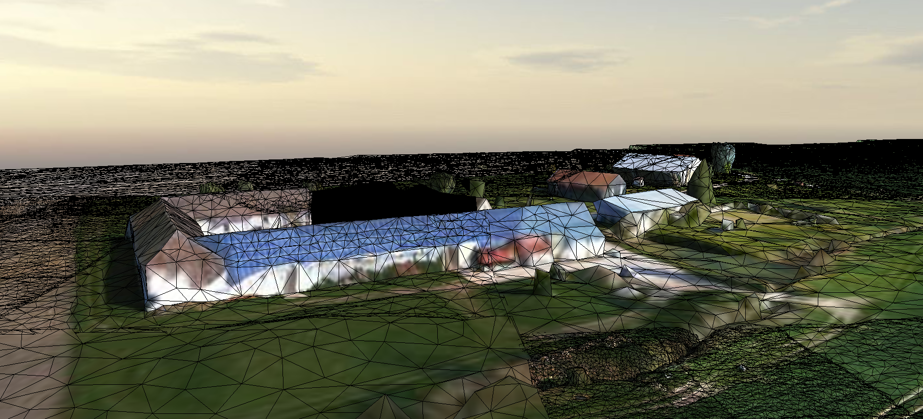
Survol d'une partie du Ru des Effervettes,en limite des communes de Nangis et Fontains, dans le département de la Seine et Marne. Les données ont été acquises par drone anafiet restituées en un maillaige tridimentionnel (mesh).
-

L’effacement des barrages de la Sélune a pour objectif de restaurer les écosystèmes aquatiques dans le bassin versant et les populations animales et végétales aquatiques. Une des conditions du succès de l’opération est la réapparition de formes fluviales diversifiées et d’habitats aquatiques diversifiés. Idéalement, le cours d’eau reprendrait son tracé et sa dynamique initiale. Cependant, la nécessaire gestion des sédiments a impliqué des interventions humaines de degrés variables selon les secteurs, avec des conséquences probables sur la morphologie du cours d’eau (sinuosité, géométrie) et sur la nature du substrat du lit (granulométrie). La lamproie marine et le saumon, candidats à la recolonisation, façonnent le substrat des cours d’eau en construisant des nids où ils déposent et recouvrent leurs œufs. Cette activité peut significativement et durablement modifier la répartition des sédiments dans les zones de reproduction et augmenter la complexité des habitats aquatiques. Le projet « rôle des espèces ingénieures dans la restauration des habitats » étudie l’influence de ces deux espèces de poissons migrateurs sur la mobilité des sédiments et la morphologie du cours d’eau dans leurs zones de reproduction. Comprendre le rôle de ces espèces est important pour suivre la restauration de la vallée de la Sélune après sa remise en continuité et le retour des grands migrateurs. Cette couche donne la localisation des secteurs d'étude utilisés dans le cadre du projet de recherche "Espèces ingénieures" ("rôles des espèces ingénieures dans la restauration des habitats").
-
La vallée de la Sélune subit actuellement d’importants changements dans la morphologie de ses berges et de son cours d’eau. Ainsi, l’analyse des interactions entre zone aquatique et zone riveraine dans ce contexte de restauration représente une opportunité scientifique unique de compréhension des mécanismes écologiques qui sous-tendent non seulement la résilience, mais aussi le fonctionnement global des écosystèmes. Le projet « interaction entre zones aquatiques et riveraines » (RestaurE) étudie le rétablissement du fonctionnement des écosystèmes de la Sélune (résilience). Il considère les interactions entre la morphologie du fleuve, la recolonisation de l’eau et des berges par la végétation et par les espèces d’invertébrés aquatiques et terrestres. Ce projet de recherche a pour objectif d’amorcer l’analyse des néo-habitats issus de la restauration de la Sélune en se concentrant sur les interactions terrestres/aquatiques au niveau des interfaces riveraines. Il permettra ainsi de comprendre le rôle spécifique de ces interactions dans le processus de résilience des écosystèmes en restauration. L’étude des interactions entre zones aquatiques et riveraines sur la Sélune est réalisée sous deux angles : (1) Caractériser le fonctionnement bio-géo-morphologique du cours d’eau et de ses berges ; (2) Étudier le fonctionnement des réseaux trophiques (aquatiques et terrestres). Cette couche donne la localisation des secteurs d'étude utilisés dans le cadre du projet "RestaurE".
-
L’ouverture des barrages va considérablement impacter le fonctionnement des populations piscicoles de la Sélune. Le rétablissement de la continuité écologique du fleuve modifiera les flux populationnels en autorisant la remontée plus en amont de certaines espèces amphihalines et le déplacement d'autres espèces vers l'aval et en amont des barrages. Depuis plus d'une 50aine d'années, de nombreuses années, l'API HUB'eau Poisson diffuse les données collectées lors d'opérations de pêches scientifiques à l'électricité réalisées par l'Office français de la biodiversité (OFB) et et ses partenaires. Ces données concernent les observations, les indicateurs, les opérations et les stations de prélèvement. Elles couvrent la France hexagonale (Corse comprise). Elles sont bancarisées dans l'outil Aspe opéré par l'OFB. L'API Poisson donne accès à la quasi totalité des données de l'outil de gestion Aspe opéré par l'OFB. Celui-ci est ouvert à l'ensemble des producteurs désireux de bancariser leurs données piscicoles. Pour toute demande d'information, merci de vous rendre sur le site aspe.eaufrance.fr. La v0 de l'API, basée sur les données de l'ancienne base IMAGE, n'est désormais plus accessible.
-
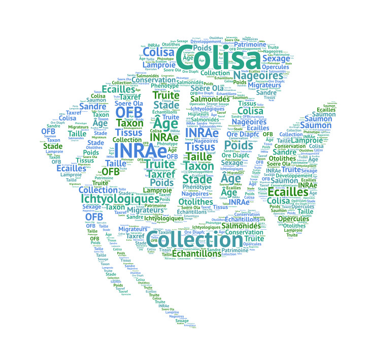
L’ouverture des barrages va considérablement impacter le fonctionnement des populations piscicoles de la Sélune. Le rétablissement de la continuité écologique du fleuve modifiera les flux populationnels en autorisant la remontée plus en amont de certaines espèces amphihalines et le déplacement d'autres espèces vers l'aval et en amont des barrages. Depuis maintenant de nombreuses années, dans le cadre de l'ORE DiaPFC (Observatoire de Recherche en Environnement Poissons Diadromes dans les Fleuves Côtiers), du SOERE OLA (Système d'Observation et d'Expérmentation pour la recherche en environnement Observatoire des lacs alpins) ou du Pôle OFB-INRAE-Institut Agro-UPPA, différentes unités INRAE (U3E, l'UMR ECOBIOP et l'UMR CARRTEL) et OFB (DRAS) prélèvent des échantillons sur de nombreux spécimens aquatiques. Ces échantillons, généralement otolithes, écailles et/ou nageoires, servent ensuite à la communauté scientifique pour effectuer différentes analyses et recherches. Ces prélèvements ont également lieu dans le cadre de l’observatoire Sélune. Labélisé Centre de Ressources Biologiques (CRB) par le GIS IBISA, Colisa fait partie du pilier environnement BRC4Env (réseau des Centres de Ressources Biologiques pour l'Environnement) de l'infrastructure RARe. Notre catalogue référence ces différents échantillons de tissus durs et propose un module permettant d'effectuer des requêtes sur notre base de données et de sélectionner les types de données susceptibles de vous intéresser. Vous pourrez par la suite exporter ces données. Ce jeu de données ne présente, en l’occurrence, aucune donnée spécifique mais permet le lien vers l'application COLISA (COLlection of Ichtyological SAmple : Collection d'échantillons ichtyologiques) permettant le stockage des échantillons prélevés. L'application COLISA nécessite la création d'un compte utilisateur pour l'accès à la totalité de la collection.
-

A very high spatial resolution Land Use and Land Cover map was produced for the greater Marino watershed (Peru) using the MORINGA processing chain. The methods involved multisource satellite imagery and a random forest model, as well as manual post-treatment. The final map provides important information for environmental management and monitoring and contributes to developing standardized methodologies for accurate LULC mapping. 3 levels are available with the training dataset
-

A very high spatial resolution Land Use and Land Cover map was produced for the greater Marino watershed (Peru) using the MORINGA processing chain. The methods involved multisource satellite imagery and a random forest model, as well as manual post-treatment. The final map provides important information for environmental management and monitoring and contributes to developing standardized methodologies for accurate LULC mapping. Classification 2019 – Level 3
-
A very high spatial resolution Land Use and Land Cover map was produced for the greater Marino watershed (Peru) using the MORINGA processing chain. The methods involved multisource satellite imagery and a random forest model, as well as manual post-treatment. The final map provides important information for environmental management and monitoring and contributes to developing standardized methodologies for accurate LULC mapping. Training Dataset
-

A very high spatial resolution Land Use and Land Cover map was produced for the greater Marino watershed (Peru) using the MORINGA processing chain. The methods involved multisource satellite imagery and a random forest model, as well as manual post-treatment. The final map provides important information for environmental management and monitoring and contributes to developing standardized methodologies for accurate LULC mapping. Classification 2019 – Level 2