 Catalogue GéoSAS
environment
Type of resources
Available actions
Topics
Keywords
Contact for the resource
Provided by
Years
Formats
Representation types
Update frequencies
status
Scale
Resolution
-
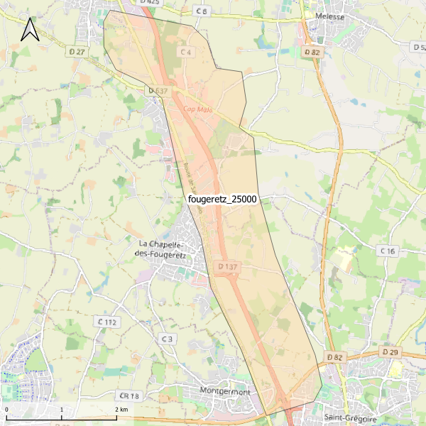
Emprise de la carte pédologique de La Chapelle-des-Fougeretz au 1/25000. La donnée de base, au format image scannée, n'est pas publiée.
-
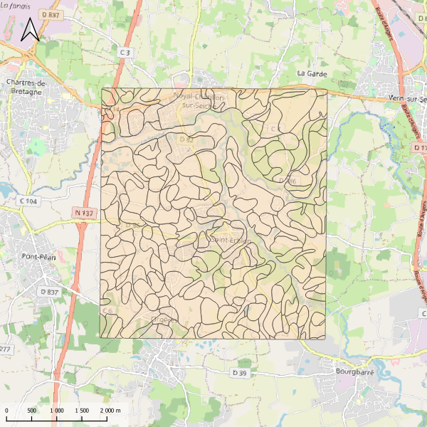
Carte pédologique du sud de Rennes au 1/25000. La codification correspond au code 4 critères des sols du Massif armoricain (voir ressources en ligne). Les champs de la table attributaire sont : - SUB : Matériau(x) parental(ux) à partir du(des)quel(s) se développe le sol - HYD : Classe d'hydromorphie, de 0 (sol bien drainé) à 9 (sol extrêmement hydromorphie) - TYPE : Développement de profil défini à partir de la succession des horizons - PROF : Profondeur du sol, classée de 1 (sols très épais) à 6 (sols superficiels) - CODE4C : code 4 critères issu de la concaténation des champs précédents. Les valeurs prises par les différents champs pour chaque entité sont détaillées dans la méthode 4 critères (voir ressources en ligne). - UTS : Numéro d'Unité Typologique de Sol issue du Référentiel Régional Pédologique de Bretagne.
-
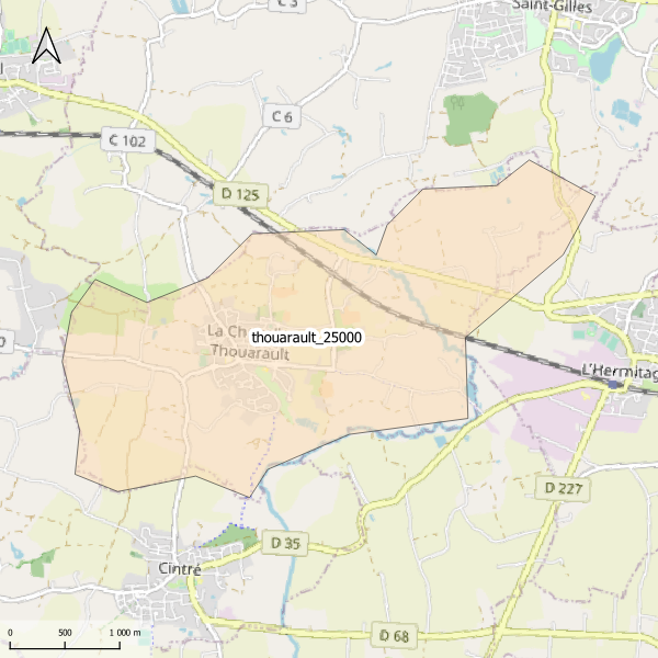
Emprise de la carte pédologique de La Chapelle-Thouarault au 1/25000. La donnée de base, au format image scannée, n'est pas publiée.
-
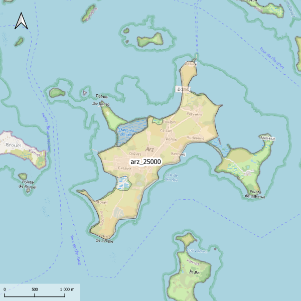
Emprise de la carte pédologique de l'île d'Arz au 1/25000. La donnée de base, au format image scannée, n'est pas publiée.
-
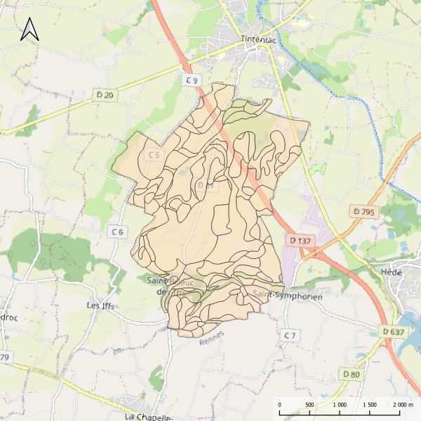
Carte pédologique de Saint-Brieuc-des-Iffs au 1/25000. La codification correspond au code 4 critères des sols du Massif armoricain (voir ressources en ligne). Les champs de la table attributaire sont : - SUB : Matériau(x) parental(ux) à partir du(des)quel(s) se développe le sol - HYD : Classe d'hydromorphie, de 0 (sol bien drainé) à 9 (sol extrêmement hydromorphie) - TYPE : Développement de profil défini à partir de la succession des horizons - PROF : Profondeur du sol, classée de 1 (sols très épais) à 6 (sols superficiels) - CODE4C : code 4 critères issu de la concaténation des champs précédents. Les valeurs prises par les différents champs pour chaque entité sont détaillées dans la méthode 4 critères (voir ressources en ligne). - UTS : Numéro d'Unité Typologique de Sol issue du Référentiel Régional Pédologique de Bretagne. Les numéros des UTS ne sont pas renseignés.
-
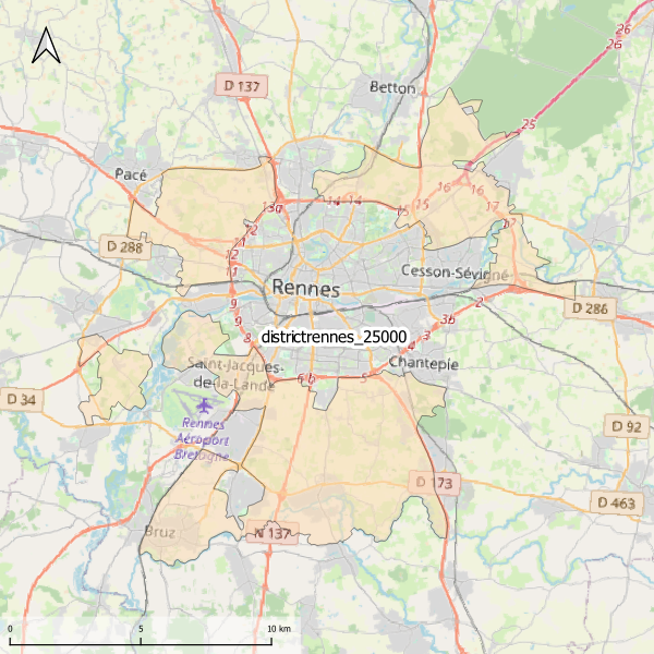
Emprise de la carte pédologique du district de Rennes au 1/25000. La donnée de base, au format vectoriel, n'est pas publiée.
-
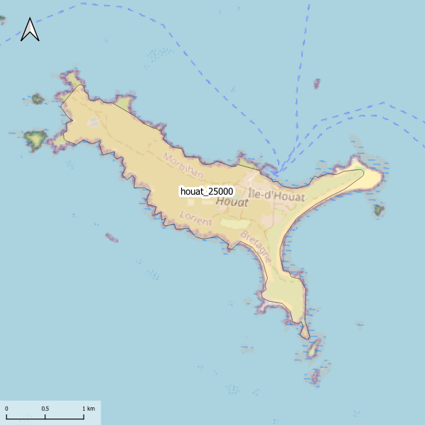
Emprise de la carte pédologique de l'Île-d'Houat au 1/25000. La donnée de base, au format image scannée, n'est pas publiée.
-
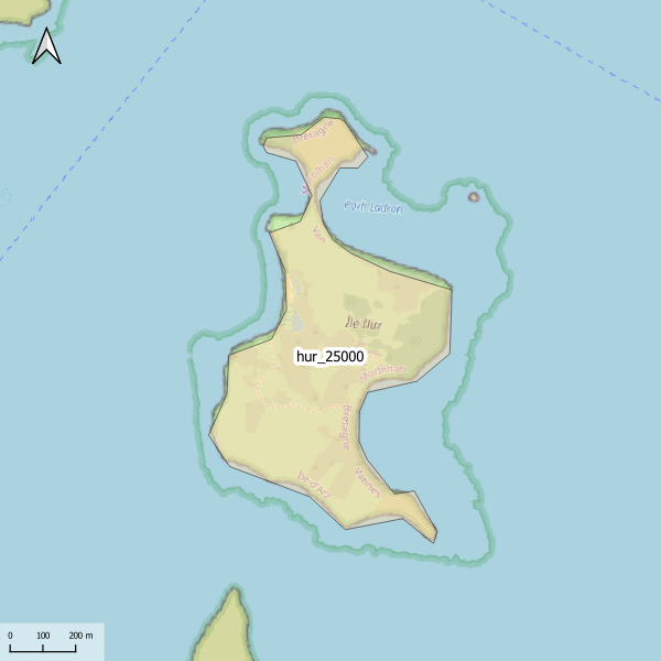
Emprise de la carte pédologique de l'île Ilur au 1/25000. La donnée de base, au format image scannée, n'est pas publiée.
-
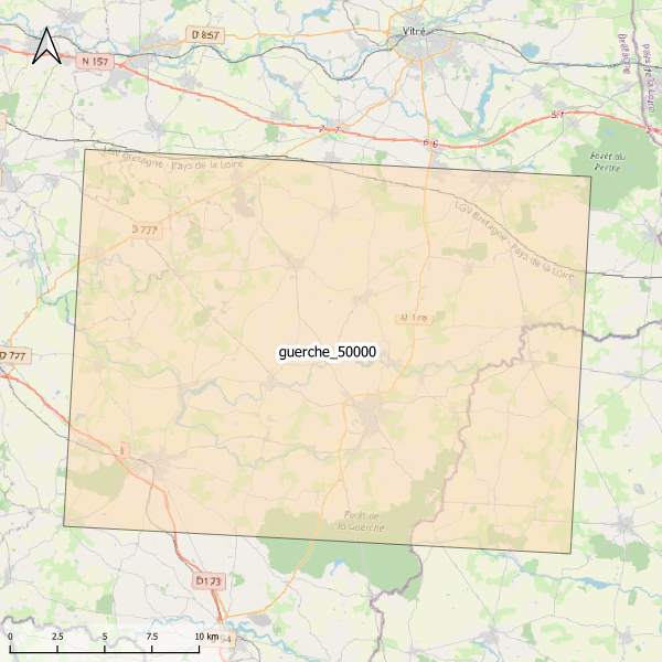
Emprise de la carte pédologique de Guerche au 1/50000. La donnée de base, au format image scannée, n'est pas publiée.
-
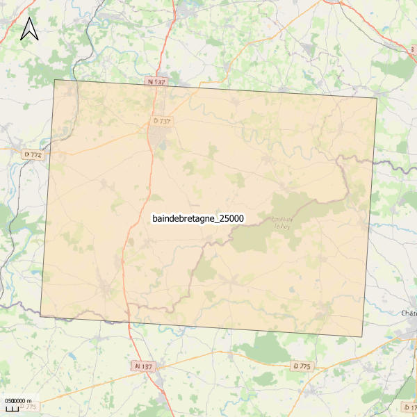
Emprise de la carte pédologique de Bain-de-Bretagne au 1/25000. La donnée de base, au format image scannée, n'est pas publiée.