 Catalogue GéoSAS
25000
Type of resources
Available actions
Topics
Keywords
Contact for the resource
Provided by
Years
Formats
Representation types
Update frequencies
status
Scale
-

Les barrages sont à l’origine de modifications significatives du régime hydrologique, de la température de l’eau et des flux biologiques et biogéochimiques. C’est le cas des barrages de Vezins et de la Roche qui Boit, présents sur le cours principal de la Sélune, et d’autres plus petits obstacles qui fragmentent le bassin versant de la Sélune. Cette couche représente les barrages hydroélectriques de la Sélune, avec les batiments associés, en lien avec la production électrique. La géométrie de ces polygones est issue de plusieurs sources : BD Topo, OpenStreetMap (de 2019), complétée par photointerprétation. Des informations extraites du livre « Quand les rivières reprennent leur cours – Notes sur l’effacement de barrages et de seuils, sur la Sélune et ailleurs » ont été ajoutées pour décrire l'état (en service ou arasé), la nature et les caractérisques physiques de ces barrages.
-
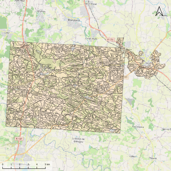
Carte pédologique de Villaumur au 1/25000. La codification correspond au code 4 critères des sols du Massif armoricain (voir ressources en ligne). Les champs de la table attributaire sont : - SUB : Matériau(x) parental(ux) à partir du(des)quel(s) se développe le sol - HYD : Classe d'hydromorphie, de 0 (sol bien drainé) à 9 (sol extrêmement hydromorphie) - TYPE : Développement de profil défini à partir de la succession des horizons - PROF : Profondeur du sol, classée de 1 (sols très épais) à 6 (sols superficiels) - CODE4C : code 4 critères issu de la concaténation des champs précédents. Les valeurs prises par les différents champs pour chaque entité sont détaillées dans la méthode 4 critères (voir ressources en ligne). - UTS : Numéro d'Unité Typologique de Sol issue du Référentiel Régional Pédologique de Bretagne.
-
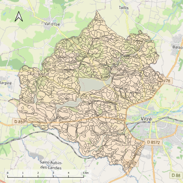
Carte pédologique de Janzé au 1/25000. La codification correspond au code 4 critères des sols du Massif armoricain (voir ressources en ligne). Les champs de la table attributaire sont : - SUB : Matériau(x) parental(ux) à partir du(des)quel(s) se développe le sol - HYD : Classe d'hydromorphie, de 0 (sol bien drainé) à 9 (sol extrêmement hydromorphie) - TYPE : Développement de profil défini à partir de la succession des horizons - PROF : Profondeur du sol, classée de 1 (sols très épais) à 6 (sols superficiels) - CODE4C : code 4 critères issu de la concaténation des champs précédents. Les valeurs prises par les différents champs pour chaque entité sont détaillées dans la méthode 4 critères (voir ressources en ligne). - UTS : Numéro d'Unité Typologique de Sol issue du Référentiel Régional Pédologique de Bretagne.
-
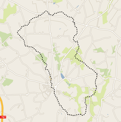
Représentation du contour du bassin versant du site de Naizin dans le Morbihan dans le cadre de l'Observatoire de Recherche en Environnement (ORE) AgrHyS de l'INRAE. Cette couche spatiale a été calculée à partir du Modèle Numérique de Terrain Mégalis à 20 m. de résolution. Ce contour correspond au bassin versant de 12km2 du cours d'eau du Coetdan, le sous bassin sur lequel les observations hydrochimiques sont concentrées depuis 1993 se situe dans les 5km2 amont.
-
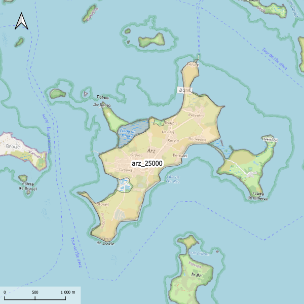
Emprise de la carte pédologique de l'île d'Arz au 1/25000. La donnée de base, au format image scannée, n'est pas publiée.
-
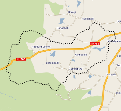
This vector map delineate the boundary of the Berambadi watershed
-
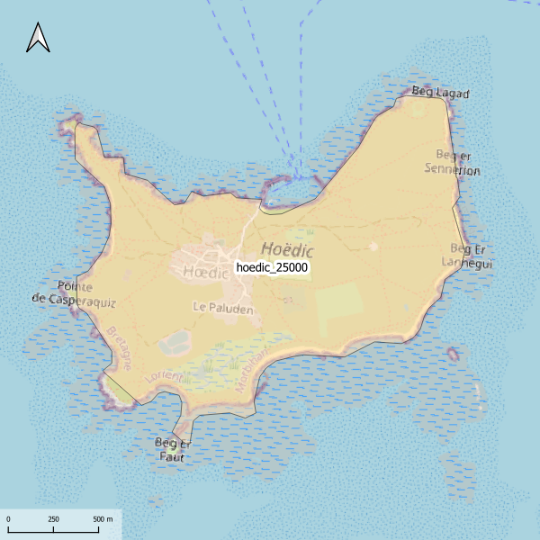
Emprise de la carte pédologique de l'île d'Hoedic au 1/25000. La donnée de base, au format image scannée, n'est pas publiée.
-
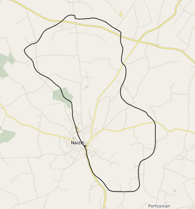
Représentation des contours du bassin versant de la zone d'étude INRA de Naizin. Ces contours correspondent au bassin versant de 12km2 du cours d'eau du Coetdan, le sous bassin sur lequel les observations hydrochimiques sont concentrées depuis 1993 se situe dans les 5km2 amont.
-
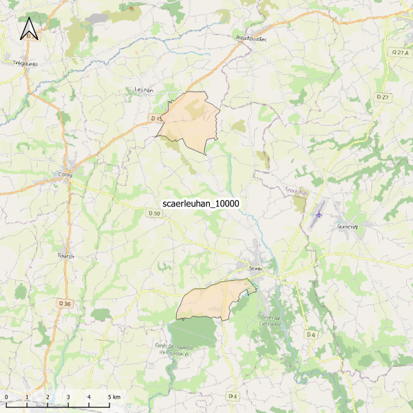
Emprise de la carte pédologique de Scaër et Leuhan au 1/10000. La donnée de base, au format vectoriel, n'est pas publiée.
-

Des stations de mesure en continu de paramètres hydrologiques, physiques, chimiques et sédimentaires ont été installées sur le fleuve Sélune, dans le cadre du programme scientifique de suivi de l’arasement des barrages de la Sélune. Sur 2 d'entre elles, un suivi des concentrations en éléments chimiques a été mis en place. Des prélèvements manuels hebdomadaires ou automatiques à plus haute fréquence lors de crues sont réalisés sur ces stations. Les analyses chimiques sur ces prélèvements sont réalisées au laboratoire de l’unité mixte de recherche SAS et qui contribuent au suivi des paramètres environnementaux abiotiques, et relèvent donc de l'Observatoire Sélune. Les concentrations analysées portent sur les éléments de la phase dissoute (phosphore dissous, anions majeurs, silice dissoute, ammonium) et de la phase particulaire (matières en suspension, teneur en carbone et en azote de celles-ci, Phosphore total).