 Catalogue GéoSAS
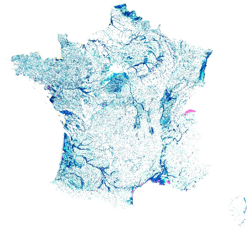
France
Type of resources
Available actions
Topics
Keywords
Contact for the resource
Provided by
Years
Formats
Representation types
Update frequencies
status
Service types
Scale
Resolution
-
Enveloppes de milieux potentiellement humides en 3 classes de confiance. La prédiction des zones humides est un enjeu majeur pour concevoir et mettre en œuvre une politique nationale cohérente visant à la préservation de ces écosystèmes fragiles mais essentiels qui sont impliqués dans la production de nombreux services écosystémiques. Fortement liée à la situation topographique, l’occurrence des zones humides potentielles est principalement conditionnée par la géomorphologie, les précipitations et la dénivelée au cours d’eau. Cette étude teste à l’échelle de la France métropolitaine le développement et la mise en œuvre d’une méthode fondée sur la combinaison d’un indice topo-climatique (Mérot et al., 2003) avec la dénivelée au cours d’eau pour prédire la distribution spatiale des zones humides potentielles. Pour plus d'informations, consulter la notice accompagnement : https://geosas.fr/metadata/pdf/Notice_MPH_France-1.pdf
-
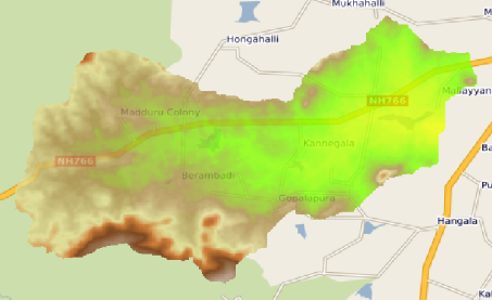
This raster map is the Digital Elevation Model of the Berambadi watershed
-
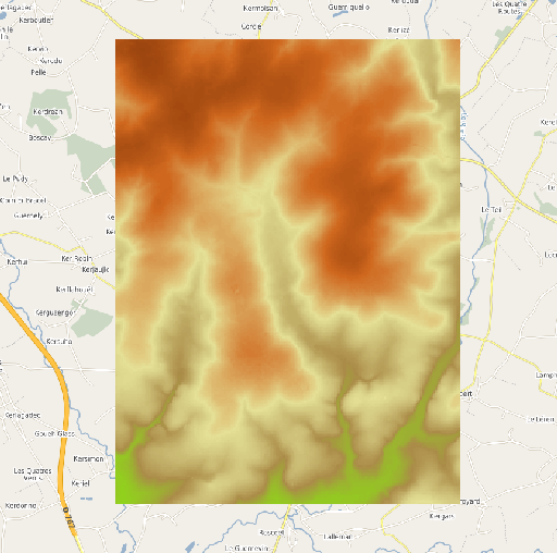
Modèle Numérique de Terrain (MNT) à 25 mètres de résolution extrait de la BD ALTI Version 2.0 de l'IGN à 25 mètres de résolution. L'emprise géographique du MNT correspond au site de l'Observatoire de Recherche en Environnement (ORE) AgrHyS de Naizin dans le Morbihan.
-
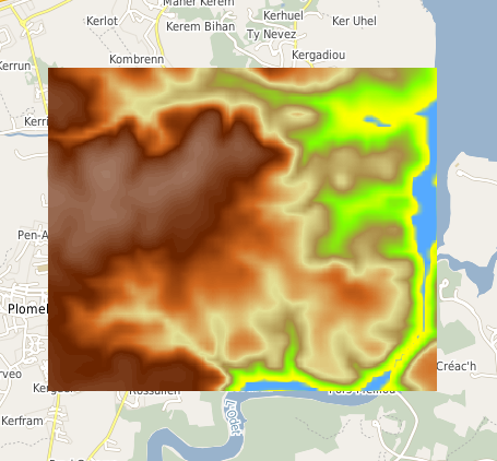
Modèle Numérique de Terrain (MNT) à 10 mètres de résolution calculé par interpolation bilinéaire de la BD ALTI Version 2.0 de l'IGN à 25 mètres de résolution. L'emprise géographique du MNT correspond au site de l'Observatoire de Recherche en Environnement (ORE) AgrHyS de Kerbernez sur la commune de Plomelin dans le Finistère.
-
Modèle Numérique de Terrain (MNT) à 5 mètres de résolution calculé par rééchantillonage basé sur la méthode de la médiane de la donnée Litto3D à 1 mètre de résolution. L'emprise géographique du MNT contient l'ensemble du site de l'Observatoire de Recherche en Environnement (ORE) AgrHyS de Kerbernez à Plomelin dans le Finistère.
-
Les frayères de lamproie marine (Petromyzon marinus) sont localisées dans le cadre de l'Observatoire Sélune. Cette espèce étant migratrice, sa colonisation de la Sélune et de ses affluents sera probablement influencée par l'effacement des barrages de la Sélune. Les frayères se caractérisent par une dépression accompagnée d’un dôme d’éjection sédimentaire immédiatement en aval. Les pierres retournées sur le dôme sont plus claires ce qui rend les nids facilement visibles et identifiables jusqu’à plusieurs semaines après le frai. Cette données est disponibles pour les années 2015, 2019, 2020, 2021, 2022, 2023, 2024 et 2025. Les rapports d'activité de l'observatoire Sélune (cf. liens ci-joints) donnent des précisions quant aux conditions de prospection.
-

L’ouverture des barrages devrait impacter le fonctionnement des populations de saumons atlantiques remontant la Sélune ou ses affluents. Le rétablissement de la continuité écologique du fleuve modifiera les flux populationnels en autorisant la remontée plus en amont des saumons atlantiques en aval et en amont des barrages. La population de saumons atlantiques est suivie sur un réseau de stations couvrant l’ensemble du bassin de la Sélune à l'aide d'un indice d’abondance, qui est effectué tous les 2 ans avant 2021 et tous les ans depuis. Les campagnes de terrain respectent le protocole de pêche mis au point par l’INRAE et l'OFB. L’objectif de cette méthode est d’estimer le niveau d’abondance de juvéniles de saumon atlantique (Salmo salar) sur une station (ou secteur). Ce protocole vise les juvéniles de l’année (d’âge 0+) dont l’abondance traduit le renouvellement des générations au sein de la population (ou recrutement) et la survie après les phases de développement embryonnaire sous gravier et les premiers mois de vie en milieu ouvert. Les campagnes de terrain sont assurées par INRAE et les Fédération de la Manche d'Ille-et-Vilaine pour la Pêche et la Protection du Milieu Aquatique (FDAAPPMA50 et FDAAPPMA35). Ce jeu de données fournit les données individuelles biométriques sur les saumons atlantiques capturés lors des sessions de pêche IAS sur le bassin versant de la Sélune, par station et par session de pêche.
-

L’ouverture des barrages devrait impacter le fonctionnement des populations de saumons atlantiques remontant la Sélune ou ses affluents. Le rétablissement de la continuité écologique du fleuve modifiera les flux populationnels en autorisant la remontée plus en amont des saumons atlantiques en aval et en amont des barrages. La population de saumons atlantiques est suivie sur un réseau de stations couvrant l’ensemble du bassin de la Sélune à l'aide d'un indice d’abondance, qui est effectué tous les 2 ans avant 2021 et tous les ans depuis. Les campagnes de terrain respectent le protocole de pêche mis au point par l’INRAE et l'OFB. L’objectif de cette méthode est d’estimer le niveau d’abondance de juvéniles de saumon atlantique (Salmo salar) sur une station (ou secteur). Ce protocole vise les juvéniles de l’année (d’âge 0+) dont l’abondance traduit le renouvellement des générations au sein de la population (ou recrutement) et la survie après les phases de développement embryonnaire sous gravier et les premiers mois de vie en milieu ouvert. Les campagnes de terrain sont assurées par INRAE et les Fédération de la Manche d'Ille-et-Vilaine pour la Pêche et la Protection du Milieu Aquatique (FDAAPPMA50 et FDAAPPMA35). Ce jeu de données fournit les données d'abondances de saumons atlantiques (0+, 1+ , 2+ et cumul) ainsi que l'indice d'abondance saumon ias, par station et par session de pêche.
-
L'étude de la végétation rivulaire dans les zones exondées repose sur l'observation des communautés végétales naturelles colonisant les vasières nouvellement exposées, à différentes échelles temporelles (variations intra- et interannuelles) et à des échelles spatiales imbriquées. L'inventaire botanique est réalisé selon la méthode de Braun-Blanquet. Le protocole d'échantillonnage est stratifié afin de maximiser la diversité enregistrée. Pour chaque zone d'étude, un transect perpendiculaire au lit de la rivière est établi, sur lequel sont positionnés des quadrats de 25m2 (5x5m). Ces quadrats sont utilisés pour l'identification des substrats ainsi que la détermination des espèces présentes (au sol et selon des strates verticales). Cette couche indique l'emplacement de ces zones d'étude, le tracé des transects et des informations concernant les quadrats enregistrées entre 2021 et 2026.
-
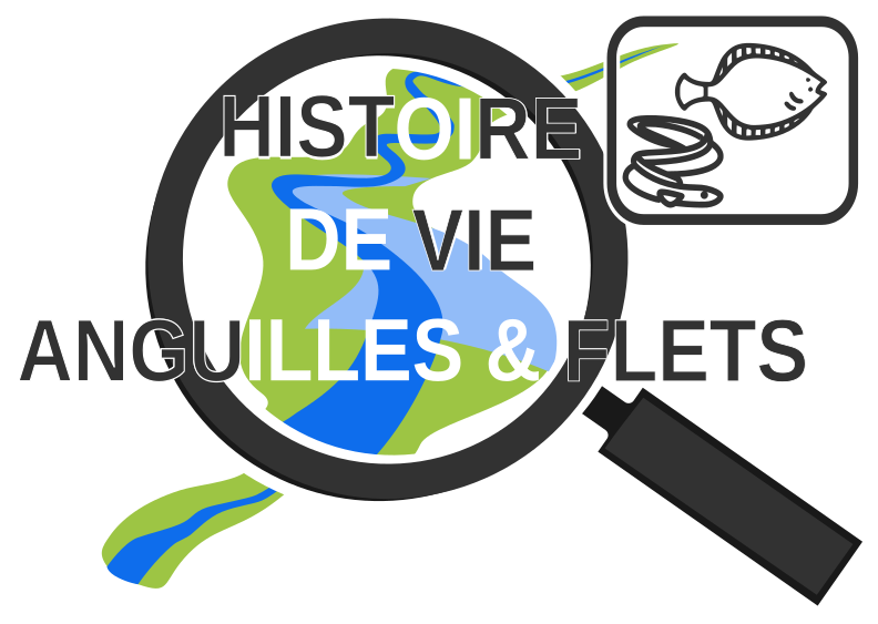
Ce projet étudie les traits d’histoire de vie de l’anguille et du flet, deux espèces migratrices qui vivent en rivière et se reproduisent en mer, avant la remise en continuité de la Sélune, afin d’anticiper ses effets par la suite. Données : - Captures d'individus d'anguilles et de flets (réalisées au moins pour dans le cadre de l'Observatoire, pour les anguilles) - Taux de graisse fat meter et extraction au chloroforme ; - Taux d’énergie (bombe calorimétrique sur les tissus musculaires) - Position et niche trophique - Age et taux de croissance - Profil de migration et d’utilisation du bassin - Prévalence et abondance des métazoaires parasites (de façon globale et pour chaque espèce de parasite), diversité des communautés parasitaires - Diversité et état du microbiome intestinal déterminés Sites : 6 sites au total : Sélune (Pêcherie + Roche qui Boit), Oir, Beuvron, Sée, Couesnon, Marais de Dol - Anguilles : 5 sites (Sélune Pêcherie + Roche qui Boit, Oir, Beuvron, Sée) - Flets : 4 sites (Sélune, Sée, Couesnon et Marais de Dol)