 Catalogue GéoSAS
environment
Type of resources
Available actions
Provided by
Years
Formats
Representation types
Update frequencies
status
Scale
Resolution
-
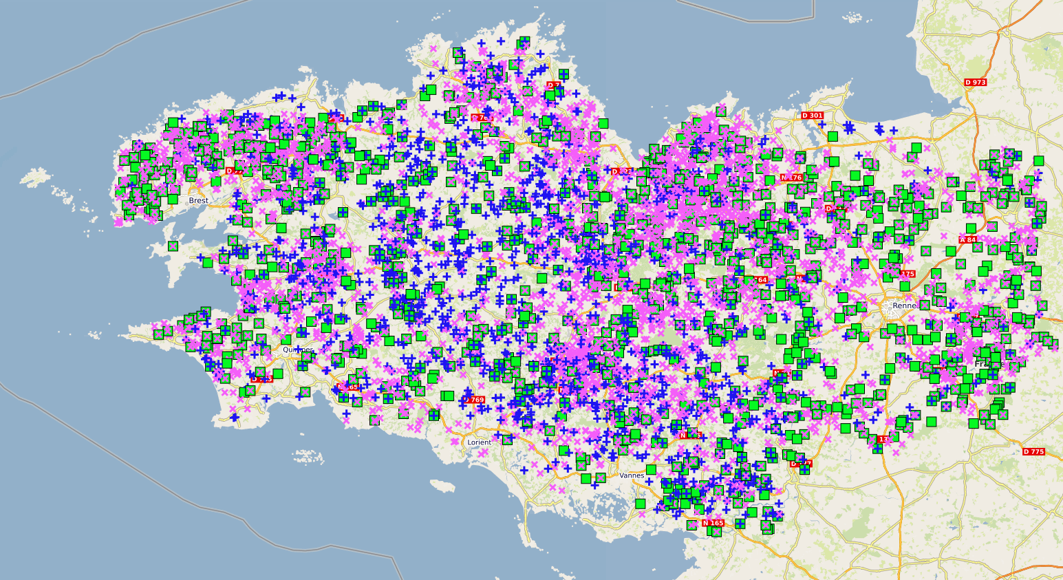
Cette donnée géographique est une extraction partielle de l'API Géorisques du Ministère de la Transition écologique et de la Cohésion des territoires. Elle représente les Installations Classées pour la Protection de l’Environnement (ICPE) de Bretagne de type agricole.
-

Dans le cadre de l'observatoire Sélune ont été disposées des stations pilotes le long du cours principal de la Sélune, réparties de l’amont à l’aval des barrages hydroélectriques. Trois stations se situent dans les anciennes retenues des barrages, les deux autres, dites de référence, sont hors zone d'influence des anciens barrages (l'une étant en aval et l'autre en amont). Dans ces stations, les biocénoses aquatiques (incluant macroinvertébrés benthiques, biofilms, macrophytes...) sont suivies. Les paramètres suivis sont la composition spécifique et le recouvrement, sur 8 stations du cours principal situées à l’amont, à l’aval et sur les zones néo-lotiques des communautés de macrophytes. La fréquence du suivi consiste en une campagne annuelle pour les stations hors retenues (S0, S1 et S5) et deux campagnes annuelles (printemps/automne) pour les stations néo-lotiques (S2, S3.4, S4.1 et S6). Le protocole mis en œuvre est le protocole d’échantillonnage des macrophytes et bryophytes suivant la norme NF T90-395 (octobre 2003) qui définit l’IBMR. Les taxa sont prélevés pour être identifiés en laboratoire. Cette couche donne La détermination des taxons s'appuie sur la version v17 de la référence TAXREF. Le jeu de données est actuellement sous embargo.
-

Les macrophytes sont un ensemble de plantes aquatiques. Elles se situent à la base de la chaine alimentaire et peuvent fournir un habitat à de nombreuses autres espèces. L’abondance relative des différentes espèces permet de calculer un indice de qualité du milieu (IBMR). Dans le cadre de l'observatoire Sélune ont été disposées des stations pilotes le long du cours principal de la Sélune, réparties de l’amont à l’aval des barrages hydroélectriques. Trois stations se situent dans les anciennes retenues des barrages, les deux autres, dites de référence, sont hors zone d'influence des anciens barrages (l'une étant en aval et l'autre en amont). Dans ces stations, les biocénoses aquatiques (incluant macroinvertébrés benthiques, biofilms, macrophytes...) sont suivies. Les paramètres suivis sont la composition spécifique et le recouvrement, sur 8 stations du cours principal situées à l’amont, à l’aval et sur les zones néo-lotiques des communautés de macrophytes. La fréquence du suivi consiste en une campagne annuelle pour les stations hors retenues (S0, S1 et S5) et deux campagnes annuelles (printemps/automne) pour les stations néo-lotiques (S2, S3.4, S4.1 et S6). Le protocole mis en œuvre est le protocole d’échantillonnage des macrophytes et bryophytes suivant la norme NF T90-395 (octobre 2003) qui définit l’IBMR. Les taxa sont prélevés pour être identifiés en laboratoire. Cette couche donne la valeur de l'indice IBMR et EQR (normé) à une station pour une campagne ainsi que les informations concernant la robustesse de cet indice, les quantités de taxons utilisés pour le calcul de ces indices mais également des informations en terme de proportion de grands groupes floristiques (heterotrophes, algues, bryophytes, pteridophytes, helophytes, phanerogrames, végétation flottante et végétation immergée).
-

Les communautés microbiennes jouent un rôle majeur dans le fonctionnement des écosystèmes : elles sont à la base de la chaîne alimentaire (production primaire) et participent à la dégradation de la matière organique. Ces communautés sont de plus connues pour répondre rapidement à des changements environnementaux. Elles peuvent être utilisées comme indicateurs écologiques, à l'instar des macro-invertébrés. Les diatomées benthiques sont les organismes photosynthétiques majoritaires au sein de cette communauté biologique. L’abondance relative des différentes espèces permet de calculer un indice de qualité du milieu (IBD). Des fortes différences de communautés entre les zones amont et aval ont été constatés quand les barrages étant en place. Elles seront amenées à évoluer après l’effacement de ces barrages. Dans le cadre de l'Observatoire Sélune, les stations sont échantillonnées tous les mois d’Avril à Octobre (7 relevés annuels) à l'aide de substrats artificiels (lames de verre disposées dans l'eau). En plus du relevé des diatomées (liste floristique, calcul de l'IBD), la concentration en chlorophylle a est mesurée. Cette couche donne la valeur de l'indice IBD et EQR (normé) à une station pour une campagne.
-

Les communautés microbiennes jouent un rôle majeur dans le fonctionnement des écosystèmes : elles sont à la base de la chaîne alimentaire (production primaire) et participent à la dégradation de la matière organique. Ces communautés sont, de plus, connues pour répondre rapidement à des changements environnementaux. Elles peuvent être utilisées comme indicateurs écologiques, à l'instar des macro-invertébrés. Les diatomées benthiques sont les organismes photosynthétiques majoritaires au sein de cette communauté biologique. L’abondance relative des différentes espèces permet de calculer un indice de qualité du milieu (IBD). Des fortes différences de communautés entre les zones amont et aval ont été constatés quand les barrages étant en place. Elles seront amenées à évoluer après l’effacement de ces barrages. Dans le cadre de l'observatoire Sélune ont été disposées des stations pilotes le long du cours principal de la Sélune, réparties de l’amont à l’aval des barrages hydroélectriques. Trois stations se situent dans les anciennes retenues des barrages, les deux autres, dites de référence, sont hors zone d'influence des anciens barrages (l'une étant en aval et l'autre en amont). Dans ces stations, les biocénoses aquatiques (incluant macroinvertébrés benthiques, biofilms, macrophytes...) sont suivies. Depuis septembre 2014, les stations sont idéalement échantillonnées tous les mois d’Avril à Octobre (7 relevés annuels) à l'aide de substrats artificiels (lames de verre disposées dans l'eau). En plus du relevé des diatomées (liste floristique, calcul de l'IBD), la concentration en chlorophylle-a est mesurée. Lors de chaque campagne, un protocole d'échantillonnage expérimental INRAe est mis en oeuvre. Ce protocole implique des dispositifs d'immersion (1 mois) de lames de verre, une mesure in situ de concentration en chlorophylle-a via BentoTorch puis une récolte du biofilm sur ces lames de verre. Le biofilm est conditionné dans (1) dans de l'éthanol à 99.9% pour la détermination des IBDs et des listes floristiques (prestation externalisée, s'appuyant sur la norme NF T90-354) et (2) dans de l'eau minérale pour mesure de concentration de la chlorophylle-a via spectromètre. NB : l'année 2023 n'est pas couverte en matière de mesure de concentration en chlorophylle-a via Spectrométrie suite à un problème de conservation basse température des échantillons. Ce jeu de données propose les mesures de concentration moyenne journalière de chlorophylle-a et de phéopigment en µg/cm2/jour
-

Les communautés microbiennes jouent un rôle majeur dans le fonctionnement des écosystèmes : elles sont à la base de la chaîne alimentaire (production primaire) et participent à la dégradation de la matière organique. Ces communautés sont, de plus, connues pour répondre rapidement à des changements environnementaux. Elles peuvent être utilisées comme indicateurs écologiques, à l'instar des macro-invertébrés. Les diatomées benthiques sont les organismes photosynthétiques majoritaires au sein de cette communauté biologique. L’abondance relative des différentes espèces permet de calculer un indice de qualité du milieu (IBD). Des fortes différences de communautés entre les zones amont et aval ont été constatés quand les barrages étant en place. Elles seront amenées à évoluer après l’effacement de ces barrages. Dans le cadre de l'observatoire Sélune ont été disposées des stations pilotes le long du cours principal de la Sélune, réparties de l’amont à l’aval des barrages hydroélectriques. Trois stations se situent dans les anciennes retenues des barrages, les deux autres, dites de référence, sont hors zone d'influence des anciens barrages (l'une étant en aval et l'autre en amont). Dans ces stations, les biocénoses aquatiques (incluant macroinvertébrés benthiques, biofilms, macrophytes...) sont suivies. Depuis septembre 2014, les stations sont idéalement échantillonnées tous les mois d’Avril à Octobre (7 relevés annuels) à l'aide de substrats artificiels (lames de verre disposées dans l'eau). En plus du relevé des diatomées (liste floristique, calcul de l'IBD), la concentration en chlorophylle-a est mesurée. Lors de chaque campagne, un protocole d'échantillonnage expérimental INRAe est mis en oeuvre. Ce protocole implique des dispositifs d'immersion (1 mois) de lames de verre, une mesure in situ de concentration en chlorophylle-a via BentoTorch puis une récolte du biofilm sur ces lames de verre. Le biofilm est conditionné dans (1) dans de l'éthanol à 99.9% pour la détermination des IBDs et des listes floristiques (prestation externalisée, s'appuyant sur la norme NF T90-354) et (2) dans de l'eau minérale pour mesure de concentration de la chlorophylle-a via spectromètre. La détermination des taxons s'appuie sur la version v17 de la référence TAXREF. Le jeu de données est actuellement sous embargo.
-

L'étude de la végétation rivulaire repose sur l'observation des communautés végétales naturelles colonisant spontanément les surfaces nouvellement exposées suite à l’effacement des barrages de Vezins et de La-Roche-Qui-Boit. Le dispositif de suivi des végétations comprend deux approches complémentaires : i) une méthode d'échantillonnage des végétations basée sur la réalisation de relevés floristiques (composition & structure) effectués au sein d’une série de quadrats positionnés le long d’un transect ii) un suivi des Unités de Végétations (UV) observées au sein de la vallée Ce jeu de données concerne spécifiquement la caractérisation globale observée sur chaque quadrat en termes de strates et concerne uniquement l'Observatoire Sélune (2021-2026). Le dispositif de suivi par échantillonnage s’appuie sur des relevés distribués en différents points de l’espace (longitudinalement & latéralement). Il vise à identifier la diversité de la flore et des végétations et décrire la structure des formations & communautés végétales émergeantes au sein de la néo-vallée. Mis en œuvre annuellement (infra-annuel uniquement pour 2021, avant démantèlement), ce suivi vise à identifier et caractériser les trajectoires d’évolution de ces végétations au cours du temps. Le protocole d'échantillonnage de la végétation est mis en œuvre au droit de plusieurs stations situées le long du cours de la Sélune et à l’embouchure de plusieurs affluents situés dans l’emprise des deux anciennes retenues d’eau. L’échantillon de stations est complété par un lot de stations positionnées en dehors de l’emprise des deux anciennes retenues, à l’aval et à l’amont, et qui constituent des stations dites de « référence ». Pour chaque station, un transect est établi perpendiculairement au chenal, depuis la berge jusqu’à un point de référence situé au niveau de l’ancienne cote de la retenue d’eau (i.e. 60m NGF pour Vezins & 28.5m NGF pour LRQB). Le long de ce transect, des quadrats de 25m² (5mx5m) sont positionnés selon des intervalles de distances fixées préalablement. Ces quadrats (nommés Q1 à Q1+n) constituent l’unité élémentaire au sein de laquelle des paramètres abiotiques (pente, texture…) et biotiques (composition, structure) sont caractérisés et évalués. Le nombre de quadrat échantillonné par station varie en fonction de la largeur de rive exondée (ou longueur du transect). Il est complété par un quadrat de référence, situé au-delà de cette cote maximale (nommé Q0). L’inventaire de la flore vasculaire i.e. les espèces végétales herbacées et ligneuses au sein des quadrats vise l’exhaustivité et une identification jusqu’au rang spécifique, voire sub-spécifique. La caractérisation globale évoquée concerne principalement, pour chaque quadrat, la typologie de sol rencontrée (cf. dictionnaire d'attribut), la pente (cf. dictionnaire d'attribut), les proportions de recouvrement en eau, sol nu et litière ainsi que, pour chacune des 6 strates détérminées (cf. dictionnaire d'attribut) : les bornes de hauteur considérées, la hauteur maximale et moyenne et la proportion de recouvrement (par rapport au 25m2 du quadrat). Cette couche donne, pour chaque quadrat de suivi de l'échantillonnage des végétations de 2021 à 2026, les informations suivantes : – Informations du quadrat (id, code, numéro et distance de son centroïde au point de référence de la station), – Informations de la campagne (id, code, date, campagne), – Informations de la station (code, nom, protocole appliqué, nombre de quadrats, code du point de référence Sélune associé et, en découlant : positionnement sur le bassin versant, distance à la mer, distance à la source et cours d’eau, altitude de référence du cours d’eau) – Informations sur le transect par campagne (numéro et longueur, coordonnées X, Y, LON, LAT des points de référence « NGF» et de fin « rive ») – Information concernant les strates (identifiées ou non), la typologie du sol, les recouvrements en eau, sol nu et litière, ainsi que le détail pour chaque strate (libellé de strate ‘muscinale’, ‘herbacée’, ‘arbustive jeune plant’, ‘arbustive basse’, ‘arbustive haute’ et ‘arborescente, les bornes de hauteur de la strate, le recouvrement associé, les hauteurs maximale et moyenne de la strate) – Géométrie « point » (par défaut) correspondant au point de référence du transect
-
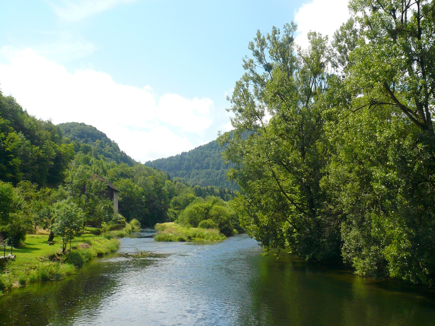
Cette carte a été produite dans le cadre de la convention 2010 -- 0190 de l'Agence de l'Eau Rhône Méditerranée et Corse concernant l'optimisation d'une méthode de quantification du rôle des corridors rivulaires sur l'état écologique des cours d'eau.
-

Dans le cadre du projet Biomonitoring et de l'observatoire Sélune ont été disposées des stations pilotes le long du cours principal de la Sélune, réparties de l’amont à l’aval des barrages hydroélectriques. Trois stations se situent dans les anciennes retenues des barrages, les deux autres, dites de référence, sont hors zone d'influence des anciens barrages (l'une étant en aval et l'autre en amont). Dans ces stations, les biocénoses aquatiques (incluant macroinvertébrés benthiques, biofilms, macrophytes...) sont suivies. 2 campagnes d'échantillonnage (printemps et automne) de macroinvertébrés benthiques (mib) sont réalisées depuis septembre 2014. Lors de chaque campagne, 2 protocoles d'échantillonnage sont mis en oeuvre : - suivant la norme NF T90-333 qui permet le calcul de l'IBG-DCE et l'I2M2 ("SURBER") - via des substrats artificiels immergés pendant 1 mois ("SUBART"), afin de se focaliser sur la mesure de « l’effet des barrages ». Le protocole est décrit dans : Piscart C., Moreteau, J.C., Beisel J.N. (2006). Monitoring changes in freshwater macroinvertebrate communities along a salinity gradient using artificial substrates. Environmental Monitoring and Assessment 116: 529-542. Cette couche détaille les taxons de macroinvertébrés benthiques et leurs abondances obtenus après analyse (selon la norme NF T90-388). Ces données sont distribuées par campagne et par secteur. Les taxons présentant l’ensemble des critères morphologiques clairement visible et caractéristique permettant l’exactitude de leur détermination et un état de conservation irréprochable sont intégrés à la collection de référence de l’Observatoire Sélune. Celle-ci est consultable sur demande (cf. point de contact). La détermination des taxons s'appuie sur la version v17 de la référence TAXREF. Le jeu de données est actuellement sous embargo.
-

Les macro invertébrés benthiques (insectes, crustacés, mollusques, vers) forment un important maillon de la chaine alimentaire. Le suivi de ces communautés permet une visualisation rapide d’un changement de conditions environnementales. Dans le cadre du projet Biomonitoring, puis de l'observatoire Sélune ont été disposées des stations pilotes le long du cours principal de la Sélune, réparties de l’amont à l’aval des barrages hydroélectriques. Trois stations se situent dans les anciennes retenues des barrages, les deux autres, dites de référence, sont hors zone d'influence des anciens barrages (l'une étant en aval et l'autre en amont). Dans ces stations, les biocénoses aquatiques (incluant macroinvertébrés benthiques, biofilms, macrophytes...) sont suivies. Les paramètres suivis sont la composition taxonomique des communautés sur 5 stations du cours principal situées à l’amont, à l’aval et sur les nouveaux habitats lotiques. La fréquence d’échantillonnage impliquent deux campagnes annuelles d’échantillonnage (printemps et automne). Les protocoles mis en œuvre sont la pose de 4 substrats artificiels (SUBART) par station et relevé après 1 mois d’immersion ainsi que 12 prélèvements Surber par station, suivant la norme NF T 90-333 (2016), permettant le calcul de l’I2M2 suivant la norme NF T 90-388 (2020) et Mondy et al., 2012. Cette couche donne la localisation des secteurs d'étude utilisés dans le suivi des macroinvertébrés benthiques ainsi que les campagnes réalisées dans le cadre du projet Biomonitoring et de l'observatoire Sélune. ce suivi a été finalisé avec les dernières acquisition terrain en 2025.