 Catalogue GéoSAS
Environment
Type of resources
Available actions
Provided by
Years
Formats
Representation types
Update frequencies
status
Scale
Resolution
-
Les barrages sont à l’origine de modifications significatives du régime hydrologique, de la température de l’eau et des flux biologiques et biogéochimiques. C’est le cas des barrages de Vezins et de la Roche qui Boit, présents sur le cours principal de la Sélune qui ont eu pour conséquence, l'existence de deux lacs de retenue entre 1919 et 2022 pour La Roche qui Boit et entre 1932 et 2019 pour Vezins. A compter de la fin de la dernière vidange du barrage de La Roche qui Boit, fin 2022, ces deux lacs n'ont donc plus d'existence dans le paysage de la vallée. Cette couche représente les deux lacs de retenues, tel qu'ils étaient référencés en 2017, soit avant le début des travaux de démantèlement des deux barrages hydroélectriques de la Sélune. Parmi les données attibutaires associées à ces deux entités, la longueur est issue d'un calcul réalisé par l'équipe du projet Sélune sur la base du référentiel de points établis sur la totalité du bassin versant (et donc sur la totalité du cours de la Sélune) et leur connaissance des zones d'influences lacs / cours naturel.
-

Le rétablissement du continuum fluvial de la Sélune après l’arasement des barrages permettra la colonisation de l’amont du bassin anciennement inaccessible aux anguilles. Avant l'arasement, deux affluents principaux étaient utilisés par les poissons amphihalins pour leur reproduction, en plus du cours principal : le Beuvron et l'Oir. La population d’anguille de la Sélune a été suivie en phase pré-arasement par des campagnes d’indice d’abondance effectuées en 2013, 2015, 2019, puis chaque année depuis 2021, sur un réseau de stations couvrant l’ensemble du réseau hydrographique de la Sélune. Ces données permettent d’estimer l’évolution de l’abondance des anguilles le long de la Sélune et de ses affluents et leur structuration en taille avant et après la destruction des barrages. L’inventaire est réalisé début septembre, une année sur deux, puis chaque année depuis 2021, à l'aide d'un dispositif de pêche électrique et d'épuisettes. Trente points de pêche de trente secondes minimum sont réalisés. Une station de pêche comprend environ 100 mètres de linéaire de cours d’eau. Toutes les anguilles pêchées sont anesthésiées et font l’objet de mesures biométriques (poids, longueur, diamètre oculaire horizontal, vertical, détermination du stade jaune ou argentée). L’ensemble des anguilles est relâché directement sur le site de pêche. Cette fiche fait référence à deux couches, l'une ne donnant que les secteurs d'étude et leur localisation et l'autre y précisant la notion de session de capture.
-
L’effacement des barrages de la Sélune fait l’objet d’un programme scientifique initié en 2012 dans lequel des paramètres environnementaux sont suivis afin de fournir un réel retour d’expérience sur cette opération de restauration. En 2019 s’est mis en place un observatoire de données, chargé d’assurer la collecte et le traitement de ces paramètres (biotiques et abiotiques). Les données acquises à partir de 2012 et au moins jusqu’en 2027, seront centralisées grâce à un système d’information (SI), appelé SISelune. SISelune vise à aider les scientifiques associés au programme Sélune et à rendre les données accessibles à tous. Cette couche présente la zone d'étude, basée sur les sous-bassins versants hydrographiques pour la partie continentale, et la masse d'eau de transition pour la baie du Mont St-Michel.
-

Le rétablissement du continuum fluvial de la Sélune après l’arasement des barrages permettra la colonisation de l’amont du bassin anciennement inaccessible aux anguilles. Avant l'arasement, deux affluents principaux étaient utilisés par les poissons amphihalins pour leur reproduction, en plus du cours principal : le Beuvron et l'Oir. La population d’anguille de la Sélune a été suivie en phase pré-arasement par des campagnes d’indice d’abondance effectuées en 2013, 2015, 2019, 2021 et 2023 sur un réseau de stations couvrant l’ensemble du réseau hydrographique de la Sélune. Ces données permettent d’estimer l’évolution de l’abondance des anguilles le long de la Sélune et de ses affluents et leur structuration en taille avant et après la destruction des barrages. L’inventaire est réalisé début septembre, une année sur deux, à l'aide d'un dispositif de pêche électrique et d'épuisettes. Trente points de pêche de trente secondes minimum sont réalisés. Une station de pêche comprend environ 100 mètres de linéaire de cours d’eau. Toutes les anguilles pêchées sont anesthésiées et font l’objet de mesures biométriques (poids, longueur, diamètre oculaire horizontal, vertical, détermination du stade jaune ou argentée). L’ensemble des anguilles est relâché directement sur le site de pêche. Cette couche contient les données individuelles sur les anguilles capturées.
-
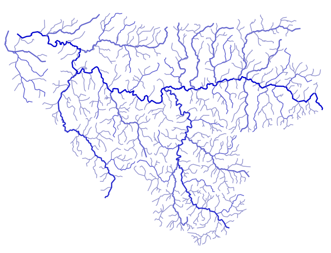
Les tronçons hydrographiques, constituants des cours d'eau, ont été extraits de la BD Topage sur l'emprise de la zone d'étude.
-

L’effacement des barrages de la Sélune fait l’objet d’un programme scientifique initié en 2012 dans lequel des paramètres environnementaux sont suivis afin de fournir un réel retour d’expérience sur cette opération de restauration. En 2019 s’est mis en place un observatoire de données, chargé d’assurer la collecte et le traitement de ces paramètres (biotiques et abiotiques). Les données acquises à partir de 2012 et au moins jusqu’en 2027, seront centralisées grâce à un système d’information (SI), appelé SISelune. SISelune vise à aider les scientifiques associés au programme Sélune et à rendre les données accessibles à tous. Le programme scientifique Sélune s'est doté d'un référentiel, composé de points. Ces points sont utilisables par tous les acteurs du programme pour désigner plus facilement n'importe quel lieu au sein de la zone d'étude. Les points sont créés le long des cours d'eau, avec une approche "Point kilométrique" (tous les 100m, en allant de l'amont vers l'aval). Chacun de ces points dispose d'un code unique, correspondant à l'association du cours d'eau (désigné par un code court) et de la distance à la source ou la confluence. Depuis 2025, chacun de ces points est également caractérisé par son positionnement sur le bassin versant (aval, amont, ...) par rapport à la zone déterminée par les anciens barrages et leurs réservoirs ainsi que leur distance à la mer sous 2 formes (LTM : Limite Transversale à la mer et LSE : Limite de Salure des eaux).
-
L’effacement des barrages de la Sélune fait l’objet d’un programme scientifique initié en 2012 dans lequel des paramètres environnementaux sont suivis afin de fournir un réel retour d’expérience sur cette opération de restauration. En 2019 s’est mis en place un observatoire de données, chargé d’assurer la collecte et le traitement de ces paramètres (biotiques et abiotiques). Les données acquises à partir de 2012 et au moins jusqu’en 2027, seront centralisées grâce à un système d’information (SI), appelé SISelune. SISelune vise à aider les scientifiques associés au programme Sélune et à rendre les données accessibles à tous. Les cours d'eau sont des entités hydrographique linéaires, liés à un toponyme principal, et décomposés en tronçons hydrographiques. Ces cours d'eau sont extraits de la BD Topage sur l'emprise de la zone d'étude. Des codes, utilisables dans le cadre du programme Sélune ont été ajoutés, ainsi que les codes issus de l'ancien référentiel hydrographique (BD Carthage).
-

En 2020 ont été mises en place des placettes scientifiques, matérialisées sur le terrain par des piquets colorés. Ces placettes ont pour objectif de faciliter le suivi scientifique, notamment de la renaturation. Ces placettes représentent des espaces privilégiés pour les scientifiques, où aucun remaniement de sédiments ou de la végétation n'est prévu jusqu'à la fin du programme Sélune.
-
Parcelles cultivées résultant de la compilation des Référentiels Parcellaires Graphiques (RPG) de 2017 et 2019. La table attributaire contient un lien vers la série temporelle de l'humidité de surfacede la parcelle depuis 2017.
-

Le rétablissement du continuum fluvial de la Sélune après l’arasement des barrages permettra la colonisation de l’amont du bassin anciennement inaccessible aux anguilles. Avant l'arasement, deux affluents principaux étaient utilisés par les poissons amphihalins pour leur reproduction, en plus du cours principal : le Beuvron et l'Oir. La population d’anguilles de la Sélune a été suivie en phase pré-arasement par des campagnes d’indice d’abondance effectuées en 2013, 2015, 2019 sur un réseau de stations couvrant l’ensemble du réseau hydrographique de la Sélune. Depuis 2021, ce réseau de station a évolué pour suivre l'évolution sur la partie du bassin versant accessible suite au démantèlement des 2 barrages. Ces données permettent d’estimer l’évolution de l’abondance des anguilles le long de la Sélune et de ses affluents et leur structuration en taille avant et après la destruction des barrages. L’inventaire est réalisé début septembre, une année sur deux entre 2013 et 2019, puis tous les ans depuis, à l'aide d'un dispositif de pêche électrique et d'épuisettes. Trente points de pêche de trente secondes minimum sont réalisés. Une station de pêche comprend environ 100 mètres de linéaire de cours d’eau. Toutes les anguilles pêchées sont anesthésiées et font l’objet de mesures biométriques (poids, longueur, diamètre oculaire horizontal, vertical, détermination du stade jaune ou argentée). L’ensemble des anguilles est relâché directement sur le site de pêche. Deux protocoles différents mis en œuvre : Indice d’Abondance Anguille (Pottier et Chapon, 2022) sur 23 stations et pêches par épuisement sur 8 autres stations (IAA01 à IAA08) sur le cours d’eau de l’Oir et certains de ses affluents selon un protocole interne. Cette couche fournit les abondances aux stations et ce par session de pêche.