Elevation
Type of resources
Available actions
Provided by
Formats
Representation types
Update frequencies
status
Scale
-

Des bornes géodésiques ont été installées le long du cours principal de la Sélune. Matérialisées physiquement sur le terrain, ces bornes ont été localisées avec un GPS de haute précision (les précisions planimétriques et z sont données dans la table). Attention, ces bornes peuvent légèrement bouger avec les cycles d'humection/dessèchement des sols principalement argileux et leurs coordonnées pourront être réactualisées le cas échéant. Les bornes géodésiques peuvent servir de repères pour définir un dispositif ou un nouveau secteur d'étude.
-

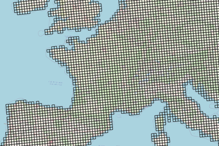
Données météorologiques Agri4cast basées sur des observations et spatialisées sous la forme d'une grille composée de mailles carrées de 625 km² (25 km ×25 km) sur la France. La table attributaire de cette couche permet d'établir le lien entre l'objet géographique (la maille) et les chroniques d'observation météorologiques via un service conforme au standard OGC SensorThings (https://frost.geosas.fr/agri4cast/v1.0/) Les observations sont : - température maximale de l'air (°C), - température minimale de l'air (°C), - température moyenne de l'air (°C), - vitesse moyenne quotidienne du vent à 10 m (m/s), - pression atmosphérique (hPa), - précipitations cumulées (mm/jour), - évapotranspiration potentielle d'un couvert végétal (mm/jour), - rayonnement global total (KJ/m2/jour). Les données météorologiques sont quotidiennes de 1979 à la dernière année civile révolue. Plus d’informations sur le portal Agri4cast : https://agri4cast.jrc.ec.europa.eu/DataPortal/Index.aspx
 Catalogue GéoSAS